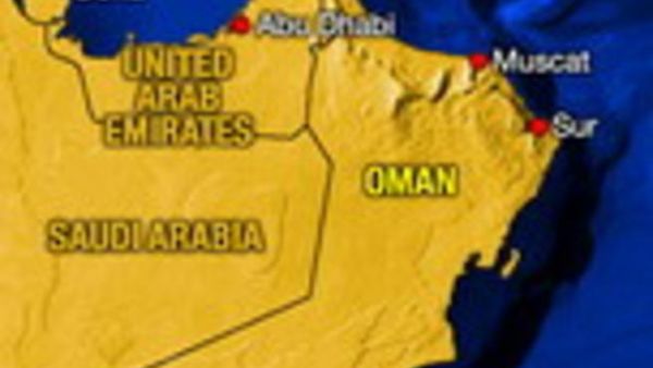
Oman army and police on Tuesday were on high alert as authorities urged people living in areas of high risk to leave before a powerful cyclone storm reaches land. Oman’s weather service warned of winds of 185 km-205 km per hour causing high waves reaching 10 meters in height.
Latest Satellite images and numerical weather predication charts indicate that the tropical storm over the Arabian Sea has intensified into a tropical cyclone centered at 18.5 North and 65 East. According to ONA, the tropical cyclone is moving in a Westerly-Northwesterly direction at a speed of 7-10 km per hour accompanied by heavy thunderstorms and very high wave heights.
The tropical cyclone is expected to make landfall within the next 24 hours.
Lt.Gen. Malik bin Sulaiman al-Ma’amari, Inspector-General of Police and Customs, and head of the National Committee for Civil Defence has announced that the Sultanate will be effected by the cyclone.
Al-Ma’amari told reporters that the cyclone known as “Gonu” is approaching the Sultanate’s lands at a speed of 18 km per hour. The Sultanate’s Easter coast is expected to be effected by the cyclone starting as from Tuesday evening.
He added that the national committee for Civil Defence has been monitoring the cyclone’s speed and its approach to the Sultanate’s coast continuously. The Directorate-General of Civil Aviation and Meteorology will issue warnings every three hours.
Lt.Gen. al-Ma’amari said Sultanate’s lower regions, such as Masirah Island, and the regions extending from Ras Madrakh to Ras Al-Had where a great deal of populations reside over there, shall be effected by the cyclone, adding that the 2/3 of Masirah Island topography is surfaced, and populated, and risk is there with the possibilities of wave height reaching 10 meter.
He said “We encourage the people to move from the hazardous areas because of the cyclone, particularly Masirah and Al-Halaniyat Islands to move to secured areas, stressing that Royal Oman Police (ROP) in cooperation with other government departments will provide shelter and food for people with no shelters through the critical period of the cyclone.
About the regions expected to be effected by the cyclone, and effect level, Lt.Gen. al-Ma’amari said the cyclone will come from the east of the Sultanate, and that the coastal area from Ras Madrakah to Ras Al-Had will witness a strong cyclone, which will head north, widely crossing the Sultanate’s lands to the direction of the Sharqiyah region, and part of Al-Hajar Al-Sharqi and Al-Hajar Al-Gharbi, penetrating the northern Batinah to the wilayats of Sohar; Liwa and Shinas. He said the cyclone speed will be high in the coastal areas while heavy rains will fall on land particularly hilly areas.


