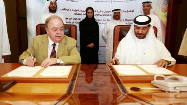
Department of Municipal Affairs signs MoU with the Cartography Institute of Catalonia

As step to enhance cooperation and exchange knowledge and experience in the Mapping Industry and Geographic Information System Field (GIS), the Department of Municipal Affairs (DMA) signed a Memorandum of Understanding with the Cartography Institute of Catalonia in Spain which is a mapping agency specialised in the field of Geographic Information System and the necessary technological systems to build and manage the Integrated Geodetic Positioning Systems and the maintenance of the topographic data.
The Memorandum of Understanding was signed by H.E. Engineer Ahmed Mohamed Al Shareef the Under Secretary of the DMA and H.E. Mr. Jaume Miranda Canals the Chairman of the Cartography Institute of Catalonia in the presence of a number of officials in the Municipal System and the Institute of Catalonia.
H.E. Engineer Ahmed Mohamed Al Shareef the Under Secretary of the DMA commented that this Memorandum of Understanding aims to exchange knowledge and experience with international institutions specialized in the GIS sector, and it goes in line with the goal of the DMA to adopt the best geographic information system and data - related services. Al Shareef added that this Memorandum of Understanding comes in line with the economic growth and comprehensive development in the Emirate forward and will enhance geospatial services provided by the municipal system to the residents and strategic partners in the public and private sector.
The Memorandum of Understanding is based on the principles of mutually beneficial interest, and is aimed at enhancing the cooperative relations in the geoinformation projects including Geodesy Mapping (topographic, orthophotographic and thematic), Geoinformation, remote sensing, Web services, Spatial Datafield Infrastructure, Subsidence detection through satellite imagery and geo-hazards, in addition to that, the MoU will exchange knowledge to create a leading on geoinformation department with sufficient means and structure as to overcome future challenges in data acquisition, processing and dissemination, and to achieve it, all parties shall exchange expertise and high-profile training mainly while carrying out production projects.
It is worth mentioning that the Department of Municipal Affairs considers the GIS to be a leading project for developing an integrated spatial data infrastructure which will enhance services in this sector to all the clients and partners of the municipal system in the public and private sector through the well-connected systems that can keep pace with the rapid growth of the spatial data sector and push economic growth and comprehensive development in the emirate of Abu Dhabi.


