
")
ALBAWABA - In a recent development reported by 9to5Google, Google has introduced a long-awaited feature to its Maps application, allowing users to navigate through tunnels and areas with limited satellite connectivity.
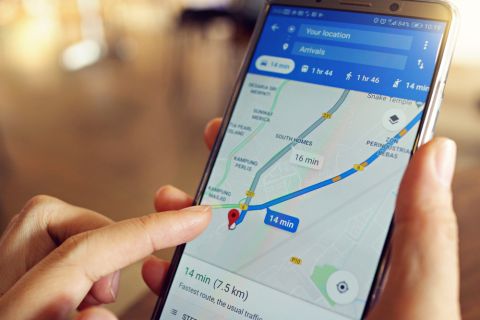
This functionality, akin to what's available in the GPS app Waze, is now accessible on Google Maps for Android, although it remains absent from the iOS version.
Bluetooth beacons, also known as Waze Beacons, are at the heart of this enhancement. These devices, strategically placed in underground locations such as New York City, Paris, Sydney, and Rio, serve the purpose of providing navigation and traffic information in areas where GPS signals may not penetrate. Operating on a low-energy microcontroller, these beacons emit a one-way signal to the user's device without collecting any personal data.
While the feature isn't activated by default, users can enable it by navigating to 'Settings' in Google Maps, then selecting 'Navigation Settings,' and finding 'Driving Options' near the bottom of the menu. Clicking on 'Bluetooth tunnel beacons' allows users to turn on this sought-after feature.
Initially presented to beta users and others in October 2023, the feature is now available in the primary version of Google Maps. It is expected to significantly enhance navigation, particularly in complex tunnels with multiple lanes and exits.
This latest addition joins a suite of new features within Google Maps, including EV charging information, AI capabilities, Immersive View, and more."


, Brent crude (C) and Dubai crude (R) in a foreign exchange dealing room at the Hana Bank headquarters in Seoul on March 13, 2026. AFP")

 shaking hands with Pakistan's Interior Minister Mohsin Naqvi before their meeting in Tehran. AFP")